
Outdoor News Bulletin
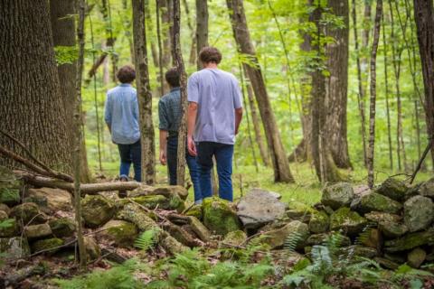
Life Under the Canopy
Adapted from a UConn Today story by Elaina Hancock
Research and Science Writer
University Communications, University of Connecticut
The forest understory, or what grows beneath taller trees, is a crucial part of the forest ecosystem. From providing food and cover for many kinds of wildlife to cycling nutrients, the understory plays many essential roles in a healthy forest.
One species that depends on certain understory habitats is the New England cottontail and Associate Professor in Residence Chadwick Rittenhouse, a researcher in the Department of Natural Resources and the Environment in University of Connecticut’s (UConn) College of Agriculture, Health and Natural Resources was interested in locating areas that could support cottontails to monitor their dwindling populations. Curious about potential methods to track these habitats down, he spoke with Zhe Zhu, the director of UConn’s Global Environmental Remote Sensing Laboratory, to see if remote sensing technologies could help.
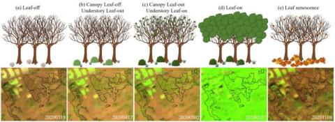
Dr. Rittenhouse and Dr. Zhu used data from a Sentinel-2 satellite, nearly 500 miles above Earth’s surface, to see what is happening beneath the tree canopy. The researchers chose data from a narrow observation window in the spring, after understory plants start greening up but before taller trees put out leaves that obscure the lower growth. “The plants in the understory grow earlier to get enough sunlight before the tree leaves close the canopy above,” explains Zhu. Data collected through satellite were compared with field observations of test plots in the UConn Forest to ensure accuracy before being used to map all of Connecticut’s understory species.
The research team’s findings are reported in the journal Remote Sensing of Environment.
These satellite images also provided data across the electromagnetic spectrum that can be used to identify plant species. Rittenhouse and Zhu could distinguish plant species with an overall accuracy of 93 percent. They learned that around 53 percent of Connecticut’s understory is now made up mainly of invasive plants such as Japanese barberry, Oriental bittersweet, burning bush, and multiflora rose. Native plants detected with satellite data included greenbrier and mountain laurel, two plants that New England cottontails use for food and cover.
The researchers are thrilled with the results. “This is one of the largest understory species mapping activities ever in remote sensing history and I think there are a lot of things we can do with this kind of product, in addition to studying wildlife habitat,” states Zhu.
The final maps can be accessed interactively.
Rittenhouse credits the success to the power of collaboration. “When you have this many people thinking deeply about a topic and trying to figure it out, it is a real benefit to have this wonderful collaboration that we have. I’m an ecologist by training, so I benefit tremendously from this collaboration and working with so many talented people who can do the things when I have an idea, and they figure out how to make it happen.”
“This is one of the largest understory species mapping activities ever in remote sensing history and I think there are a lot of things we can do with this kind of product, in addition to studying wildlife habitat.” - Dr. Zhe Zhu, Director of UConn’s Global Environmental Remote Sensing Laboratory
Collaborations with academic partners, such as UConn’s understory mapping project, continue to increase our ecological and biological understanding of the New England cottontail, and are essential to the implementation of the Conservation Strategy for the New England Cottontail.
For more resources about New England Cottontail conservation efforts, go to the Young Forest Initiative’s website.


