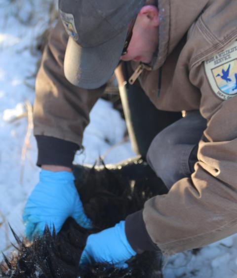
Outdoor News Bulletin
Monitoring the Sea Otters in Glacier Bay National Park
A team of scientists from the Colorado Cooperative Fish and Wildlife Research Unit, Colorado State University, and the National Park Service are developing contemporary models and aerial survey techniques for estimating sea otter abundance and distribution in Glacier Bay National Park.
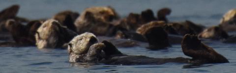
Sea otters were formerly extirpated from southeastern Alaska due to commercial fur trade in the 18th and 19th centuries. However, increased regulation of the fur harvest, recolonization efforts by wildlife agencies, and natural range expansion has resulted in sea otters recolonizing much of their former range. As a result of the range expansion, sea otters reached the mouth of Glacier Bay National Park in 1993, and have since colonized other parts of the park. Sea otters are now widely distributed throughout Glacier Bay.
Sea otters are a keystone species that can dramatically change the marine food web. The best-known, and most studied example of food-web change due to sea otters is the effect of sea otter predation on sea urchins. Sea urchins feed on kelp, and when sea urchin abundance is large, they can completely consume a kelp forest. The resulting loss of kelp forests is detrimental to many marine species that depend on kelp. Sea otters prevent kelp deforestation by feeding on sea urchins and regulating their abundance.
After sea otters arrived in Glacier Bay National Park, the USGS, in collaboration with the National Park Service, began monitoring sea otter abundance and how abundance changed across Glacier Bay through time. Monitoring the abundance and distribution of sea otters provides a necessary foundation for understanding sea otter colonization of Glacier Bay and their impacts on invertebrate prey populations. Ultimately, long-term monitoring of sea otter abundance and distribution in Glacier Bay will provide an important indicator of the health of this uniquely productive glacial fjord in one of the world?s largest marine protected areas.
Aerial Surveys
The USGS has been conducting sea otter surveys in Glacier Bay since 1993 by counting sea otters from planes and noting the location of each count. Challenges associated with conducting these aerial surveys have included: 1) safety and budget restrictions, limiting the amount of flight time available for surveying otters; 2) observational challenges preventing some sea otters from being counted (observational challenges include: otters that are foraging underwater, glare on the water limiting visibility, and otters being camouflaged by kelp); and 3) sea otters colonizing new parts of Glacier Bay each year, resulting in a survey design that needs to be repeatedly updated to address the expanding population, while remaining financially feasible.
Aerial photography has proven useful for efficiently monitoring other marine species, such as harbor seals, and the approach is being adapted for sea otters in Glacier Bay to address the observational challenges associated with counting sea otters. Aerial photographic surveys are more efficient than traditional survey methods because the team can survey more area with more direct flight routes. The improved efficiency increases personnel safety and decreases cost.
Additionally, unmanned aerial vehicles (UAVs, or drones) may also prove useful for surveying sea otters. A survey design that uses aerial photographs with manned aerial vehicles can easily transfer to UAVs, as the methods and technologies are developed.
Sea Otter Sampling
To address the sampling challenge associated with sea otters colonizing new areas of Glacier Bay, the team of scientists has developed statistical techniques to predict the spatial-temporal movement of sea otters across Glacier Bay. These new statistical techniques incorporate life history traits of sea otters and habitat covariates of Glacier Bay to predict which areas sea otters will colonize in the future.
Using statistical predictions, future surveys can be designed so that observers in aircrafts visit areas that were previously unoccupied by sea otters, but have a high probability of being occupied in the future. This increases efficiency by focusing efforts in areas that have a high probability of being occupied by otters, while limiting efforts in areas that are less likely to be occupied by otters. As future surveys are conducted, additional data are gathered; the additional data facilitates the evaluation of model predictions, and allows researchers to refine predictions of distribution and abundance through time.
The combination of modern statistical techniques and survey data based on aerial photographic methods provides a cohesive scientific framework for learning about sea otter ecology and colonization dynamics, and designing efficient monitoring protocols while maximizing safety and minimizing cost.
The ONB features articles from Cooperative Fish and Wildlife Research Units across the country. Working with key cooperators, including WMI, Units are leading exciting, new fish and wildlife research projects that we believe our readers will appreciate reading about. This article was written by Dr. Perry Williams, postdoc at the Colorado Cooperative Fish and Wildlife Research Unit.