Outdoor News Bulletin
Taking the Pulse of the Boreal Forest
Swimming up the sweeping, curved path of the Yukon River, salmon undertake a 2,000-mile journey home to spawning streams across Alaska and Canada and ultimately passing through the Yukon capital of Whitehorse. Here, in a place joined by the river but separated by political boundaries, a group of monitoring experts met last month to better integrate our understanding of the region, but only after passing the invisible, plumb-straight line separating Alaska from Canada. More than 30 experts in areas of wildfire, vegetation, permafrost, contaminants, and invasive species are trying to figure out how to collect research and monitoring data that can be used across the vast forests, mountains, and glaciers of the boreal forest in Alaska and Canada, regardless of the jurisdictional boundaries.
WMI?s Colleen Matt and Chris Smith, two wildlife experts with decades of experience in Alaska and western North America, teamed up with the Northwest Boreal Landscape Conservation Cooperative (NWB LCC) to take the first steps of creating a coordinated monitoring system in boreal Alaska and Canada. NWB LCC is a US-Canada science and conservation partnership comprised of more than 30 stakeholders from government, academia, Tribes/First Nations, non-governmental organizations, and industry working towards a shared future. Leveraging the vast network of partners? work is a major opportunity, according to US Chair and Kanuti National Wildlife Refuge Manager, Mike Spindler.
?Our partner organizations have scientists working all across the region, from Western Alaska, across the Yukon and into the Canadian Rockies in NWT Canada,? said Spindler. ?In many cases it would not take much extra effort for them to add a coordinated monitoring feature to their work. By coordinating their methods and efforts, our partners hope to be able to determine the extent of long-term changes.?
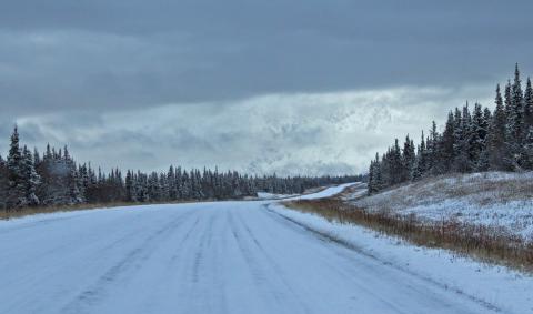
This century?s drivers of change eclipse borders; bigger wildfires and new invasive species don?t stop at the US-Canada border. And the pace of change in the boreal is accelerating from climate change and new land use patterns. Air temperatures have warmed 1.4 degrees Celsius (2.5 F) and expanded the growing season by half. Many spruce-dominated forests are expected to become covered by broadleaf species like aspen and birch. Amid this outlook, reaching a shared vision of a functioning boreal system and healthy communities takes working together at new scales and in new networks.
WMI Western Field Representative Chris Smith in an earlier workshop compared the coordinated effort to a bush pilot flying a small plane on a bad weather day. If you?re flying blind, what are the instruments that you absolutely need to make decisions and chart the path forward?
?Most agencies tend to think in shorter funding cycles in terms of specific management mandates, questions or a specific piece of geographic regions like a refuge or park,? said Smith. ?Getting people to step back and think on a longer time scale and at a landscape level is different than the typical decision framework that most agencies work in.?
The idea is not to launch a new and expensive monitoring network, but rather to find what commonalities exist in current monitoring programs or what small tweaks would allow for data to scale and be meaningful to other researchers in a landscape setting. The workshop focused on finding the metrics that best capture change and determine what minimum standards for collecting data would make the data usable. At a time when several agencies are willing to look at their monitoring plans, the focus is on making existing data usable to track changes across the boreal. But to know what to do, we have to know where and how the landscape is changing due to climate change, new development, and changing land use patterns.
NWB LCC Coordinator Amanda Robertson said that is the charge before the partners in Alaska and Canada. ?We have to monitor to know which trajectory we are going towards because we have to make appropriate management decisions based on the trajectories. We need a change detection system, a way to have a finger on the pulse of the landscape,? she said.


