Outdoor News Bulletin
Integrating Unmanned Aircraft Systems to Support Informed Decision Making
The need for cost-effective monitoring of wildlife populations and habitat is common to natural resource managers in many state and federal agencies as well as to the private sector. Small Unmanned Aircraft Systems (sUAS) have immense potential as a tool to fill the gap between a biologist on the ground with a pair of binoculars, and satellite imagery. The University of Florida Unmanned Aircraft Systems Research Program (UFUASRP) was the first in the U.S. and possibly the world, to custom design a sUAS explicitly for natural resources assessment and monitoring. Scientists at the USGS Florida Cooperative Fish and Wildlife Research Unit are working with UFUASRP to solve specific ecological questions.
Bigger is Not Always Better
The sUAS has significant advantages in portability, ease of use, and mission flexibility when compared to larger sUAS designed for military uses. The UFUASRP is working with its fifth-generation of sUAS, the Nova 2.1 (the only sUAS developed specifically for natural resources applications!). The aircraft is completely battery powered, weighs 14 pounds fully loaded, and has a nine-foot wing span. The aircraft is hand-launched and flown over the target study area. The evolution of the Nova 2.1 was spawned by rapid technological developments such as miniaturization of digital cameras, new frontiers in battery and materials technology, and the rapid development of high capacity memory components.
Deployment of Real World Applications
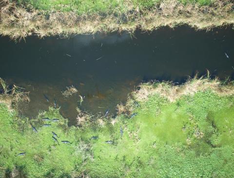
The researchers have deployed the Nova 2.1 in a variety of real world applications. The Nova 2.1 payload on a manned aircraft might deliver data that are far superior to visual estimates of human observers, and also eliminate the need for trained observers in the manned aircraft. The capability has already provided a handy, quantitative solution to a long standing problem of estimating turnover in colonial nesting birds. The Florida Unit has also teamed with the University of Idaho to evaluate fine scale characteristics of pygmy rabbit habitat, and estimate burrow density. In collaboration with Idaho Fish and Game, the sUAS will be used to estimate Chinook salmon redd density in relation to habitat characteristics, and to estimate white pelican colony size.
Computer scientists and ecologists and the University of Central Florida are using sUAS data to estimate nesting sea turtle population size and to differentiate beach tracks of loggerhead, green, and leatherback turtles. Colorado State University is teaming with the University of Florida to assess water bird distribution and abundance at the Patuxent Naval Air Station. The Mote Marine Laboratory in southwest Florida will use sUAS data to estimate abundance and size class distributions of assemblages of rays near Sarasota. The USGS Southeast Ecological Science Center and Florida Fish and Wildlife Conservation Commission are collaborating to provide novel statistical techniques for estimating abundance from sUAS data.
Testing sUAS for the USGS
The Florida Unit is collaborating with the UFUASRP, the Wildlife Ecology and Conservation Program, and the Geomatics program to develop and field test sUAS tailored to the requirements of the USGS UAS Program. The goal of the USGS UAS program is to support informed decision making across the Department of the Interior. It has worked closely with other agencies and academia in support of common interests in this emerging technology. The Department of the Interior (DOI) acquired Raven-A fixed wing and T-Hawk rotor wing small UAS systems which had been retired from the Department of Defense. USGS is conducting proof-of-concept projects in many parts of the U.S. and have trained several teams of scientists to conduct such missions addressing DOI objectives within mining, fish and wildlife biology, geology, and related natural resource disciplines. The USGS UAS desires to advance their technological capabilities beyond the Raven A and T Hawk.
Challenges and Opportunities
A limitation of sUAS technology is its range and deployment in situations where sample points or targets of interest are widely separated. Examples are surveys of manatees at warm-water refugia or salmon redd surveys in the Snake River, Idaho/Washington. The targets may be separated by scores of miles within a range of their 150 mile or greater extent and must be surveyed within a small temporal window. The sUAS might deliver very appropriate data but logistics preclude their use over such a large extent.
Huge Potential
The examples above illustrate that UAS also have the ability to provide wildlife ecologists not just static images, but highly accurate and repeatable geographic information system (GIS) products. This opens the door to investigations at a novel and extremely appropriate geographic scale for wildlife, and the ability to produce statistically robust results. When coupled with the ability to fly in remote areas dangerous for manned aircraft, and remove human safety from the picture, UAS could turn out to be as important to ecologists and managers as satellite imagery has been.
The ONB features articles from Cooperative Fish and Wildlife Research Units across the country. Working with key cooperators, including WMI, Units are leading exciting, new fish and wildlife research projects that we believe our readers will appreciate reading about. This article was prepared by Raymond Carthy, Unit Leader, USGS Florida Cooperative Fish and Wildlife Research Unit at the University of Florida.


